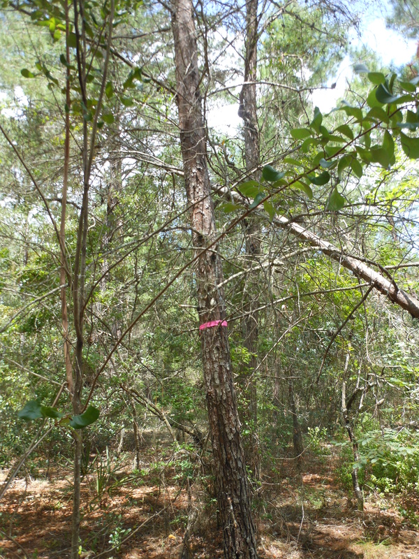
But, Before We BeginThe last kids of the kidding season are on the ground so now it’s time to turn our attention back to land development and planning. We’re now in March and the time to get the annual plantings in the ground is at hand. In order to maximize our efforts and yields we’ve got to move from sketching to cementing out ideas as far as the overall farm layout is concerned. Must Bee Kiddin’ Farm is just over ten acres. Right now only one person works it full-time and a second joins in to help bear the workload on weekends. Ten acres may not sound like a very big spread, but when you consider that it’s undeveloped and densely wooded, it’s easy to get overwhelmed. The best way to get past those feelings of overload is simply to just get working. Energy begets energy. Momentum over meditation! With that in mind, it’s important to have some solid action plans fleshed out. At this stage of the game major mistakes are pretty hard to make since we’re still pretty much in sandbox mode. As we’ve stated before, we’ve adopted the basic tenets and guiding principles of Permaculture in the development of Must Bee Kiddin’ Farm. At the center of Permaculture is a design plan that utilizes is zonal development. Permaculture design makes use of a five zone system and this drives the development and layout of the property. The zonal layout scheme Permaculture emphasizes helps with focus and keeps the thinking centered on the big picture. But, before even delving into any Permaculture zone planning we must pull back one frame of focus and look at the big picture. Before laying out any zones it’s best to chart the land concentrating on land features and the major weather patterns at play on the land. 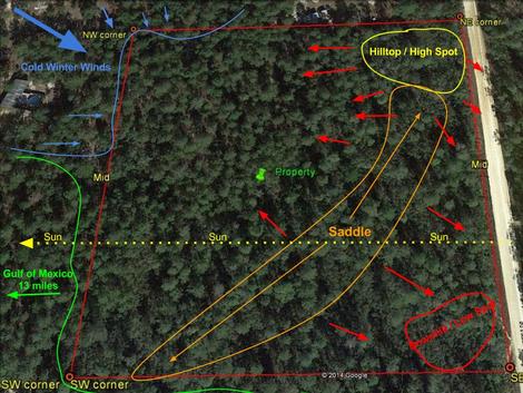 Land features and weather patterns on Must Bee Kiddin' Farm. Land features and weather patterns on Must Bee Kiddin' Farm. This picture illustrates the prevailing weather patterns by season as well as highlights the main topographical features on the Must Bee Kiddin’ Farm. This property picture is from 2013 and is accurate up to the time of purchase. Nothing had been done to the property or adjoining properties until the time of our purchase. The first, main feature of the farm is the fact that it’s pretty much a square. It aligns with the compass as the top property line is north, the right is east, the left west and the bottom property line is south. Thus the track of the sun is from right to left.
As I’m writing this, today’s (3/1/2015) temperature was pushing eighty degrees (F). That being said, we just had an overnight low temperature in the low twenties less than four days ago. Subtropical means contending with hard freezes just about every year. This is why this weather and land feature map is important. In not only paying specific attention, but mapping the prevailing seasonal weather patterns and land features, extremes can be mitigated. In other words, if we pay close enough attention to the lay of the land and which way the winds blow we can use this to our advantage when it comes to land development. Microclimate identification and exploitation become critical for extending growing and increasing yields. The hilltop situated in the northeast corner of the property is the highest point on the farm. The section marked saddle is a ridge that runs to the southwest and joins with another hilltop that is situated on the neighbor’s property to the south. The elevation of that saddle is about ten feet with low spots in the southeast and, to a lesser extent northwest and southwest corners of the property. With cold winds blowing in from the northwest, the saddle acts as windbreak. Cold northwest winds are mitigated by that saddle and the southeast corner of the property becomes favorable for more tropical plantings such as bananas. The weather map also becomes important when deciding where forest stands need to be kept, thinned or bolstered. If cold winds sweep in through the northwest corner, that’s a good place to consider a plantation of longleaf timber pines to stand guard against Jack Frost’s devious notions and Old Man Winter’s bitter bite. On the flip side, thinning the southwest and southern lines becomes important. Being in coastal Florida means hurricane season is always a consideration. So there it is, Must Bee Kiddin’ Farm’s weather and basic topographical map. After mapping the basic landscape features and considering the prevailing weather patterns we’re now ready to get into the meat and potatoes land development plan. Developing this weather and land feature map was a pretty simple exercise, but definitely time well spent. In the next installment of the Must Bee Kiddin’ Farm development plan we’ll talk Permaculture zone development. //mr
0 Comments
Yep, sure enough 2014 just flew by and the new year just rolled right in with what seemed to be a blink of the eye. Before we let 2014 get small in the rear view mirror here's the latest tour of the property's west line as it stood on the last workday of the year. Of course the video shows the state of the west line but I'll also bullet point the main items outlined and discussed. Talking Points
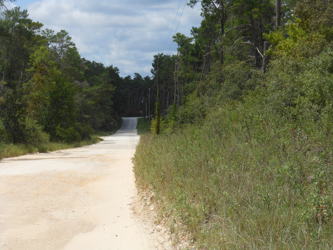
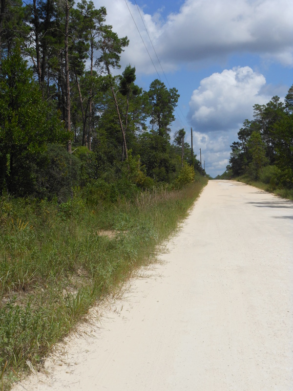
//mr This video shows the south border and completes the preliminary tour of the land. Next up will be setting fence posts!!! This video will give you an idea of what your east border is like. This border sits alongside our road.
The third in a three part series of articles that will give you some insight as to why we chose this particular piece of property.
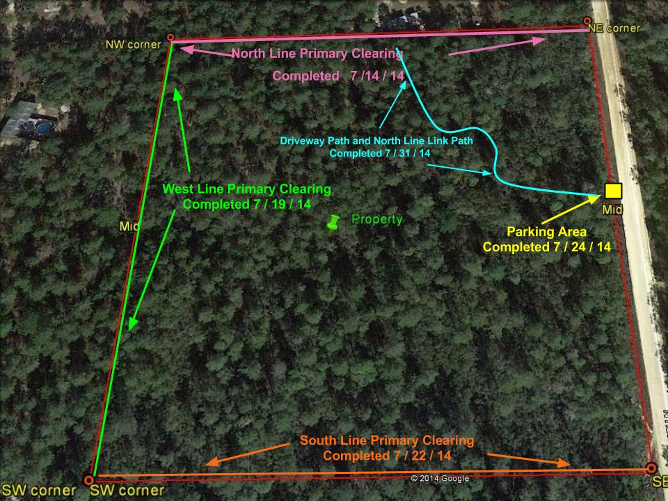
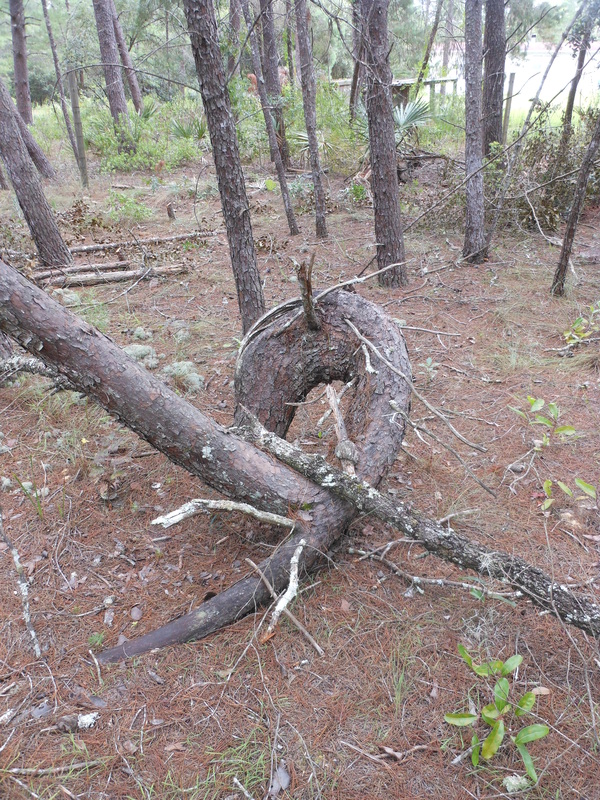
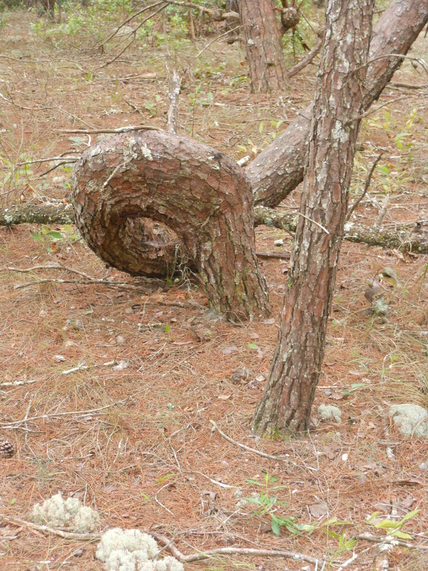
When chronicling any endeavor or adventure it’s always best to start at the beginning. This certainly holds true when it comes to establishing a sustainable farm in ten acres of heavily wooded Florida pine scrub. Property hunting certainly calls for some selection criteria. It also demands some soul-searching, vision and a very good sense of humor. The property hunt and how we finally settled on purchasing the land we did is as good a starting point as any. Here’s what made our latest purchase the right place at the right time. Elevation/Contour/Shape This criteria ties a bit back into the access criteria. Elevation in Florida is rare, but is important for all the previous reasons mentioned. Now, couple this with the fact that we wanted to stay coastal (within 20 miles of Gulf) due to sea breeze, and things start to fall apart. Fortunately for us there is a bit of undulation in our county that provides a bit of elevation for safety. While elevation in a potential hurricane is easy for most to understand, contour--not so much. With elevation comes some contour, but not necessarily a lot. Well, to understand contour as a criteria some local climate experience is necessary past the USDA growing zone guide. What if I told you that the area we’re in gets just as much (if not more) rain annually as Seattle, yet xeriscaping landscape design is still advised? Water conservation in our parts is reality. Capturing and controlling water so it seeps rather than runs is essential and contour makes that possible. The last criteria was the desired shape of the plot. We wanted to be able to easily subdivide the property into chunks for cultivation and eventually individual livestock paddocks. Badly misshapen lots often make for wasted space with costly perimeter fencing bills. Ultimately contour and usage will shape the internals of the property, but perimeter boundaries are easier to define and maintain when the overall layout is in a uniform shape. Square or rectangular property is just easier to define. Lastly, a square or rectangular property is easy to separate from the bordering properties (in our case, other heavily wooded and unmaintained lots) with fire lines and roads. In the pine scrub of Florida wildfires start quickly and run rampant through decades of dry branches and matted pine needles on the forest floor.//mr The next line we worked on getting preliminarily cleared was the west line. This was a lot easier than the north line, by far. Enjoy the tour! This video shows the north border of our property after preliminary clearing. The short-term goal was to establish a safe and quick way to get from the front of the property to the back of the property. This was the first area we worked on. We just need to tidy up a little more, then it will be ready for fence posts to be set. We thought it might be fun to give you all a monthly wrap-up of what we have accomplished. We started working on our 10 acres July 12, 2014. We had a 10 day plan in place, that we met and continued onto our next set of goals. The most important goals were to clear the borders so that we could essentially walk completely around our property. We also wanted to carve out a parking area so that we could park on our own land instead of in the right-of-ways.
Our next set of goals included creating a path so that we could easily walk to the northern border from our parking area. Future goals will include paths to the west and south borders. We are quite proud of ourselves for meeting our first set of goals.//tr The second in a three part series of articles that will give you some insight as to why we chose this particular piece of property. When chronicling any endeavor or adventure it’s always best to start at the beginning. This certainly holds true when it comes to establishing a sustainable farm in ten acres of heavily wooded Florida pine scrub. Property hunting certainly calls for some selection criteria. It also demands some soul-searching, vision and a very good sense of humor. The property hunt and how we finally settled on purchasing the land we did is as good a starting point as any. Here’s what made our latest purchase the right place at the right time. Wooded/Raw The second major criteria we had for any potential property purchase was that we wanted something raw with plenty of trees. You know, a relatively untouched and wooded lot. Why? Well, several reasons, but primarily due to climate concerns. We are in a subtropical environment (USDA growing zone 9B) and the sun is very intense. The premium that shade offers is evident when driving past some of the commercial nursery growing operations. Growers utilizing acres of irrigation under shade cloth in order to protect young plants isn’t unusual. The natural shade wooded acreage affords calls for no major infrastructure investments other than some strategic trimming and clearing. For us, selective cutting and clearing was something we were willing to invest time in doing. Creating “edge effect” through removal rather than planting and waiting just seemed like a better option. Gotta be thinking Michelangelo’s David here. No way is there room for anything other than a full piece of marble. No pre-shaped slab is going to do (hold that thought). On a practical note, wooded lots in our area are often undervalued and overlooked. Many potential buyers looking for acreage are horse-loving retirees relocating to a hobby farm with pasture. The last thing many of them can do is clear land themselves or waste precious time waiting for it to be cleared. Also, land clearing is expensive and a good way for capable people to save a bit of coin when starting out. So, concentrating on wooded acreage took some of the property competition (the overpaying horse crowd) out of the equation. Now, back to Michelangelo. Raw, vacant land was just about the only non-negotiable criteria. Why? Because we wanted to put ourselves in the best position to work WITH the land. We want to make sure we’re in a position to become the best stewards of our plot possible. Rarely is there a perfect piece of property, so why complicate things even further by having to accept a previous owner’s incongruous vision? Again, something that was just a non-negotiable in our view. So, with an untouched wooded/raw lot, the prices in our geography is more realistic and much less open to any bidding competition. With our fully wooded lot in the raw we’re also able to take our time or open things up full-throttle as we see fit. No wasted time repairing old buildings or broken systems. In essence, our full-sized marble slab is ready and waiting to be chiseled and shaped into our masterpiece.//mr |
About UsIn 2014 a couple of 40-somethings decided to make a change. The purchase of 10 raw, pine scrub acres along Florida's Nature Coast started it all. This is that story. Archives
March 2018
Categories
All
|

 RSS Feed
